


Keep your customers informed.
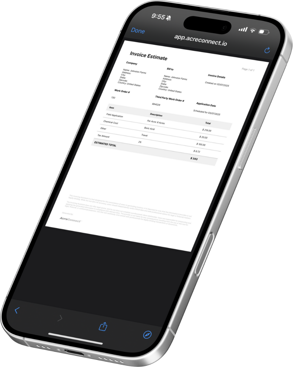
- Send estimates, product usage reports, application maps and invoices directly to customers via email or text, keeping them informed and satisfied.
- Application maps provide customers with visual evidence of your work. This transparency builds trust and demonstrates the quality of your service.


Help customers get a full view of their operation.
- Our integrations with popular farm management platforms like John Deere Operations Center™ and Climate FieldView™ make it easy for your customers to access and use your application data within their preferred systems.
- Combining AcreConnect™ drone data with farm management platforms helps farmers to get a 360-degree view of their farms, aiding with analysis and decision-making.
Win loyal customers with professional service delivery.
- By improving communication, efficiency, and transparency, AcreConnect™ helps operators deliver professional and reliable services, fostering customer loyalty and satisfaction.
Let's get started!
CREATE YOUR FrEE account
With your free AcreConnect™ account you get:
- Automatic enrollment in a 30-day free trial to try out the features before you buy
- In-app onboarding tour and online chat tool
- Access to key features
- In-app demo videos of features like FAA reports
- Ability to securely store your flight logs for DJI and XAG drones
- Access our knowledge center, how-to videos and customer support
NO CREDIT CARD REQUIRED.
Getting started is easy:
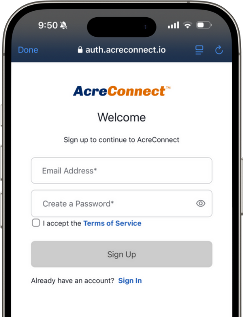
- Visit app.acreconnect.io/signup
- Click "Sign Up".
- Enter your email address and a create a password.
1AcreConnect™ requires data connectivity.
2Application Maps are functional in FieldView™ via manual upload only.
3Invoice Assistant is not connected to or integrated within any payment software and will not calculate any applicable tax rates. Invoice Assistant is not intended to replace other invoicing systems, but is designed to complement other billing systems you may have.
4AcreConnect™ is connected to John Deere Operations Center™ via John Deere APIs.